The Freeway Gets a Bridge, and the Mountains Get Their Connection Back
The wound The 101 freeway through Agoura Hills is one of the busiest stretches of road in the country. For the animals of the Santa Monica Mountains, it’s also a wall. Mountain lions, bobcats, gray foxes, coyotes and mule deer living south of the freeway have been largely cut off from the Simi Hills and the Santa Susana Mountains to the north. Many that tried to cross died on the road. The mountain lions have paid the most. Hemmed in by freeways and the ocean, the small population in the Santa Monica Mountains has been inbreeding, and National Park Service researchers have tracked the genetic damage for years. The most famous lion in the region, P-22, made it across both the 405 and the 101 to reach Griffith Park, where he lived alone for the rest of his life. He became the face of the campaign to build a way across.
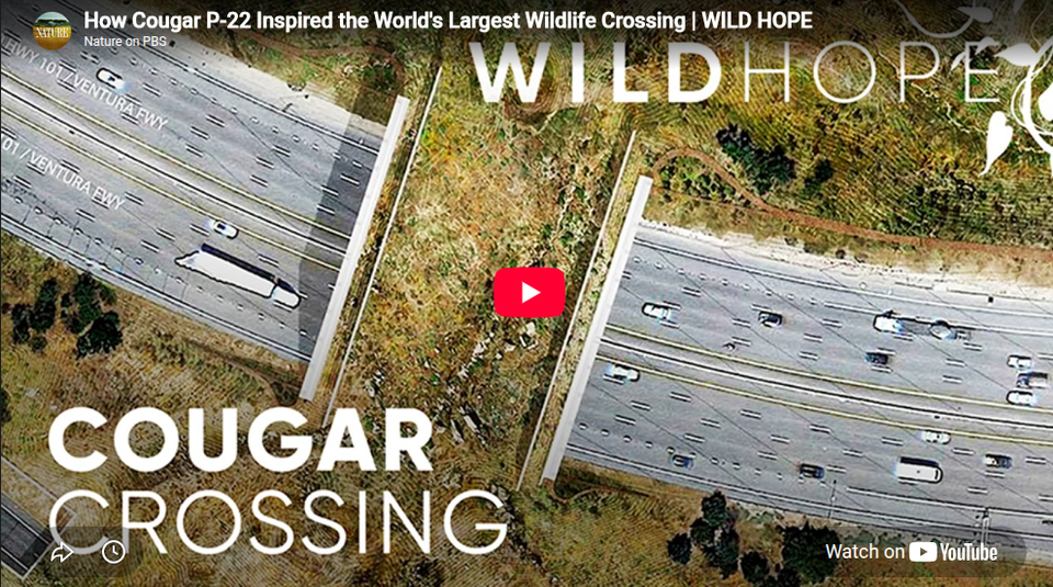
The repair The Wallis Annenberg Wildlife Crossing is a planted bridge over the 101 at Liberty Canyon. It’s about 210 feet long and 174 feet wide, and it’s covered in soil and native plants instead of pavement. Caltrans calls it the largest wildlife crossing of its kind in the nation. Its backers bill it as the largest in the world. Construction began on Earth Day 2022. The main bridge over the freeway was finished in June 2025. The second stage, a crossing over Agoura Road plus earthwork and habitat restoration on both sides, has run right up to opening. Record rains two springs in a row pushed the original 2025 target back. The crossing is for animals only. People get a viewing area, not a path.
What’s being restored It isn’t a building or a landmark. It’s a connection: the old path between the mountains that the freeway cut. A bridge alone doesn’t heal that. The bridge has to look and smell like home to a wary animal, so the project is planting native vegetation grown from more than a million seeds hand-collected nearby by an Indigenous-led nursery team. Planting and finishing work will continue after opening, and the habitat will take years to grow in. The crossing is also one link in a longer chain: the habitat corridor that runs north from the Santa Monica Mountains through the Simi Hills toward the Los Padres National Forest. What happens upstream in our own hills, including how the Santa Susana Field Lab is cleaned up, will help decide how well that corridor works. Who paid for it Caltrans owns the project. The money came from public and private sources: the Annenberg Foundation (including a $25 million challenge grant), other private donors, the California Wildlife Conservation Board, the Santa Monica Mountains Conservancy, the State Coastal Conservancy, and thousands of contributors to the #SaveLACougars campaign run by the National Wildlife Federation and the Santa Monica Mountains Fund. Caltrans lists about $92 million in programmed project costs. The figure most often reported for the full project is about $114 million. When it opens The crossing is scheduled to open to wildlife on December 2, 2026. The same day, a public ribbon-cutting and P-22 Legacy Celebration runs from 11:30 a.m. to 3:30 p.m. at King Gillette Ranch. Tickets are $10 for ages 13 and up and $5 for children, with proceeds going to #SaveLACougars, and a livestream is planned. What we’ll be watching A ribbon-cutting is a beginning, not a result. The real story is the one wildlife cameras will tell over the next few years: the first coyote to cross, the first deer, and someday a mountain lion from the south meeting one from the north. We’ll follow that story here.
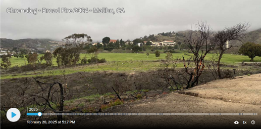
The Broad Fire burned much of the area surrounding Malibu Bluffs Park on November 6, 2024 (Malibu, CA). This Chronolog station helps the City of Malibu to document the natural recovery of this open space after the fire damage.
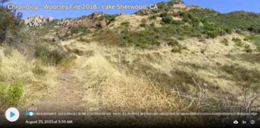
The November 2018 Woolsey Fire burned over 96,000 acres. Post-fire landscapes in southern California are probably one of the most dramatic examples of vegetation recovery from apparent fire destruction, and photo series are one of the most effective educational tools to show this kind of change over time. New technology allows park visitors to become citizen scientists and actively participate in the collection of data to document this kind of change and to see the results in the future.
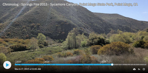
Southern California Wildfire Recovery. Much of Point Mugu State Park and Rancho Sierra Vista burned in the May 2013 Spring Fire. Post-fire landscapes in southern California are probably one of the most dramatic examples of vegetation recovery from apparent fire destruction, and photo series are one of the most effective educational tools to show this kind of change over time. New technology allows park visitors to become citizen scientists and actively participate in the collection of data to document this kind of change and to see the results in the future.
Mitigation banking lets development provide funding for restoration projects, turning construction into conservation.
By purchasing credits from habitat restoration projects, cities and builders can offset damage while financing the recovery of rivers, wildlife corridors, and fire-scarred land.
Public photo stations like Chronologs make these efforts visible, allowing anyone to document regrowth and hold agencies accountable.
Together, these tools transform environmental compliance into community-powered restoration.
Major Water Infrastructure Restoration Projects in the U.S.
Water infrastructure restoration projects are underway across the United States, addressing aging systems, environmental concerns, and future water security.
Kissimmee River Restoration
Location: Florida
Description: Completed in 2021, this project restored 40 miles of the river and nearly 25,000 acres of wetlands.
Posted to YouTube by Florida Atlantic University's Center for Environmental Studies: improving Florida’s sustainability through research, education, and community engagement on wetlands ecology and coastal resilience. For more information, visit www.ces.fau.edu
Environmental Restoration Allies
Restoration ICU is Seeking Partners
We are seeking reliable sources of content for this section and sponsorship. If you would like to collaborate or feature your articles here, please contact us.
The Floral Reef Project provides ideas and resources to help you create pollinator-friendly habitat.
The Floral Reef Project was formed to increase awareness of the need for conservation and protection of pollinator habitat, to provide ideas and resources for individuals and groups, and to create fundraisers and donation drives to directly support local efforts around the world (starting in Southern California)
Upright Farms
Upright Farms believes that small farms in Southern California have the power to cultivate more than just crops and livestock—they can cultivate communities, drive economic growth, and inspire sustainable living.
Whether you’re a grower, a consumer, or someone looking to make a positive impact, we’re here to connect farms and people for the betterment of all.